Alaska Summer 2023

I arrived in Alaska in the middle of June. Since then, I’ve been learning my new job, getting to know the good people I work with, and settling into my apartment, neighborhood, and now, church. But I’ve also been cramming as much mileage on my car as possible and taking all the pictures I can. I’m blessed with a short commute, so during the week I don’t drive very far. Instead, I have redistributed all that mileage to the weekend, in an attempt to probe just how far you can reasonably get in a single day. My only wish is that there were more roads to drive down – for being the largest state in the Union, Alaska only has a few highways.
There are, in fact, only two ways to leave Anchorage – you can go south on the Seward Highway, or north on the Glenn (and technically on the Old Glenn, but that’s almost the same thing). So, over the first couple of weekends, I probed south, along a road which hugs the broad tidal flats of Turnagain Arm, which separates Anchorage from the Kenai Peninsula. At the end of the Seward Highway is, well, Seward, the town named after the great Secretary of State who arranged Alaska’s purchase, and who is one of my favorite American politicians. Near Seward is the Exit Glacier, which is itself merely a tiny protuberance of the much larger Harding Icefield. If, instead of going to Seward, you turn onto the Sterling Highway and drive about 140 miles further, you will come to Homer, a town built on and around a spit of land jutting into Kachemak Bay. When I was there, the mountains just across the bay seemed to be emitting a strange cloud of fog or dust which almost seemed to glow.

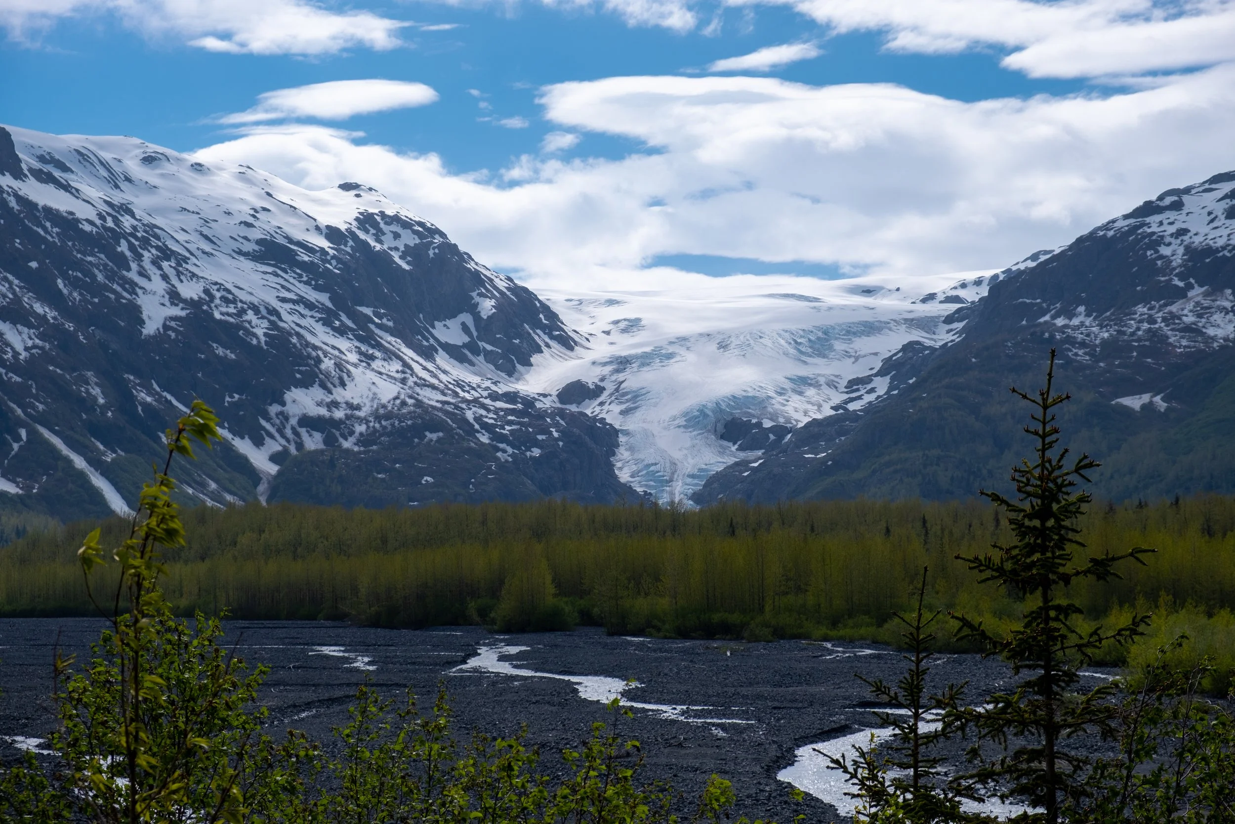

For the long weekend of the Fourth of July, I turned North. Just northwest of Anchorage, the Matanuska Glacier creeps across the valley floor, bizarrely lower than the highway, a monstrous incongruity of ice. Continuing on, I turned south, slipped through a darkly verdant canyon of hanging glaciers that seemed to exhale clouds and equally white waterfalls, and came to Valdez. If you look at the third picture below, on the right you’ll see the modern port and on the left the terminus of the Trans-Alaska pipeline, from which oil is shipped out through Prince William Sound. It was there, just a few miles out of Valdez, on Good Friday, 1989, that the Exxon Valdez ran aground and spilled its cargo into the sea. And, in the foreground of the photo, you can see some of the land on which the town used to sit, before it was destroyed by subsidence in the 1964 earthquake, the most powerful ever recorded in North America. As a consequence of the earthquake, the entire town was relocated. This earthquake, of course, also took place on Good Friday.


I did a silly thing, leaving Valdez – I treated it as a short detour on my way further east, and tried to reach McCarthy, which sits at the end of 60 miles of dirt road, the extremity of another road. I tried to reach it in the same day in which I had left Anchorage and visited Valdez, and I almost got there (though it would have been very late). Unfortunately, bouncing along the potholes, the seal on my oil pan came loose, and I suddenly discovered there was an indicator light on my car that I’d never seen before. Fortunately I was able to make it back to Glennallen where there is what has to be the busiest gas station in the state. Having thus altered my plans impromptu, I slept in my car for a couple of hours, and when I stepped outside for just a few second, I found myself immediately covered in vicious mosquitoes. They are somehow even worse than described.
As I proceeded north up the Richardson Highway, I discovered the reason why. It turns out that the typical interior landscape of Alaska is a series of enormous ponds and marshes, stretching as far as the eye can see, and incubating untold trillions of mosquito eggs. But just a little further, and it all became worth it, as I crossed the Alaska Range, and saw its brilliantly-colored slopes. And there, in front of them, like something out of a dream, ran the pipeline. I wasn’t surprised to see it, of course, but I still wasn’t quite prepared for how strange it looks, like an alien spacecraft landed on earth. And it just went on and on, without ceasing. It reminded me of the Great Wall receding, ridge after ridge, into the hazy distance.


I stayed in a small cabin in Delta Junction, and I was thrilled to discover myself in the landscape that has so long fascinated my imagination – the endless birch woods of the north. I imagine the Sweden of my ancestors, I try to imagine medieval Russia and the river routes to Byzantium and Baghdad, and I cannot imagine the vastness of Siberia, try as I might. But these woods are a picture of it.


The following day I headed south again, but this time I turned off to the west, to cut over the highlands on the Denali Highway, over a hundred miles of dirt road that mostly runs over land just barely too high to grow trees – which is not as high as you’d think. To the north, under the louring sky, gaps in the wall of mountains opened here and there to disgorge colossal frost-giants. Across my path, rivers unspooled like silver threads on green silk.


After that weekend, I decided to stay closer to Anchorage, so I went up to the Independence Mine, an abandoned mining town which is now a public park. It wore a forbidding aspect, as twisted and broken mine cart rails hung in the fog and rain, and it was difficult to picture as it must have been, filled with people and bustling with life.


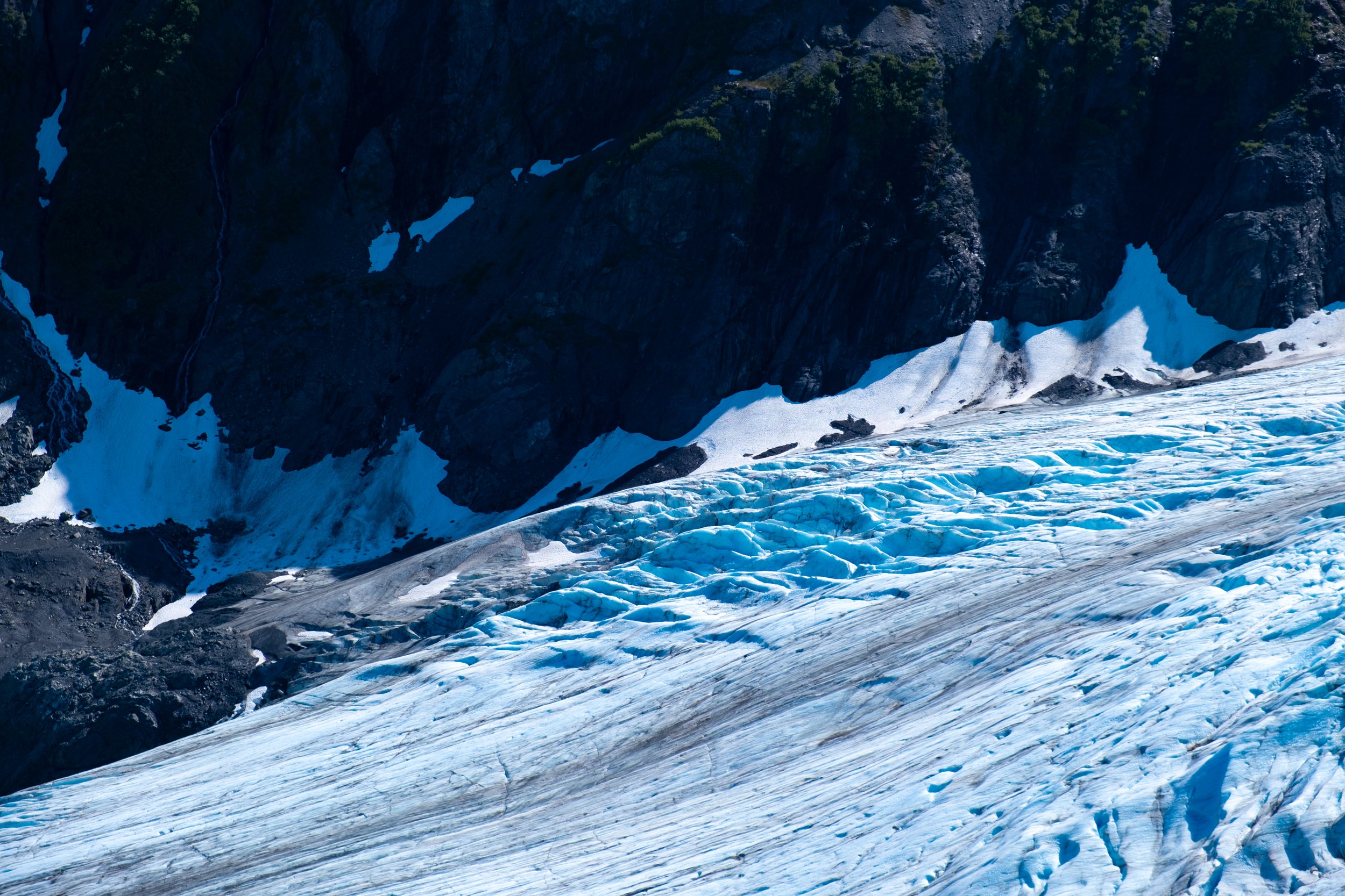
I have a fascination with glaciers, and as soon as I became aware of the Exit Glacier trail, I knew that hiking it had to be a top priority. The trail starts almost at sea level, in the birch forests along the river coming from the base of the glacier. From there its stone stairway climbs three thousand feet up, skirting the edge of the Exit Glacier. The summit holds the prize: an unbeatable view into just a portion of the vast Harding Icefield, which extends beyond the horizon. There’s nothing quite like gazing into a vast sea of ice. I even spotted a tiny figure walking across a part of the ice; you can see them in two of the pictures below.
The problem I ran into was not ascending the trail, but descending. I had not done a hike like that in a couple of years, and going down the stone stairs I was beset by terrible leg cramps and fits of shaking. Fortunately I had plenty of daylight to burn, and I was able to use the distended descent time to listen to a fascinating history of Stalin’s gamesmanship of the Central Committee in the early ‘20s. Of course, I don’t know if I can use that term in the same way any more – after all, we are now in the early ‘20s once more. And the whole way down, the glacier glowed an intense blue in the evening sun, tempting me to toboggan down it.


Alaska was a Russian colony before it was purchased by Seward, and I visited some of the beautiful Russian Orthodox churches that dot the Kenai Peninsula. In the village of Nikolaevsk, settling in the 1960s by Old-Rite Russian Orthodox, I even found an onion dome sitting on the grass, like you’d find a car in other rural parts of the country. Perhaps it was being patched up to be reinstalled somewhere.


On a different weekend, I traveled north to Denali National Park. Staying in a cabin next to a pack of sled huskies, I got a taste of the extended lilac hour, which in the Alaskan summer last much longer. The next day, I rode a bus into the park. Though I never got a clear view of the mountain due to its perpetual cloud-cover, I did see two bears, some wild sheep, and a landscape that looks like my romantic imagination of the Mongolian steppe.


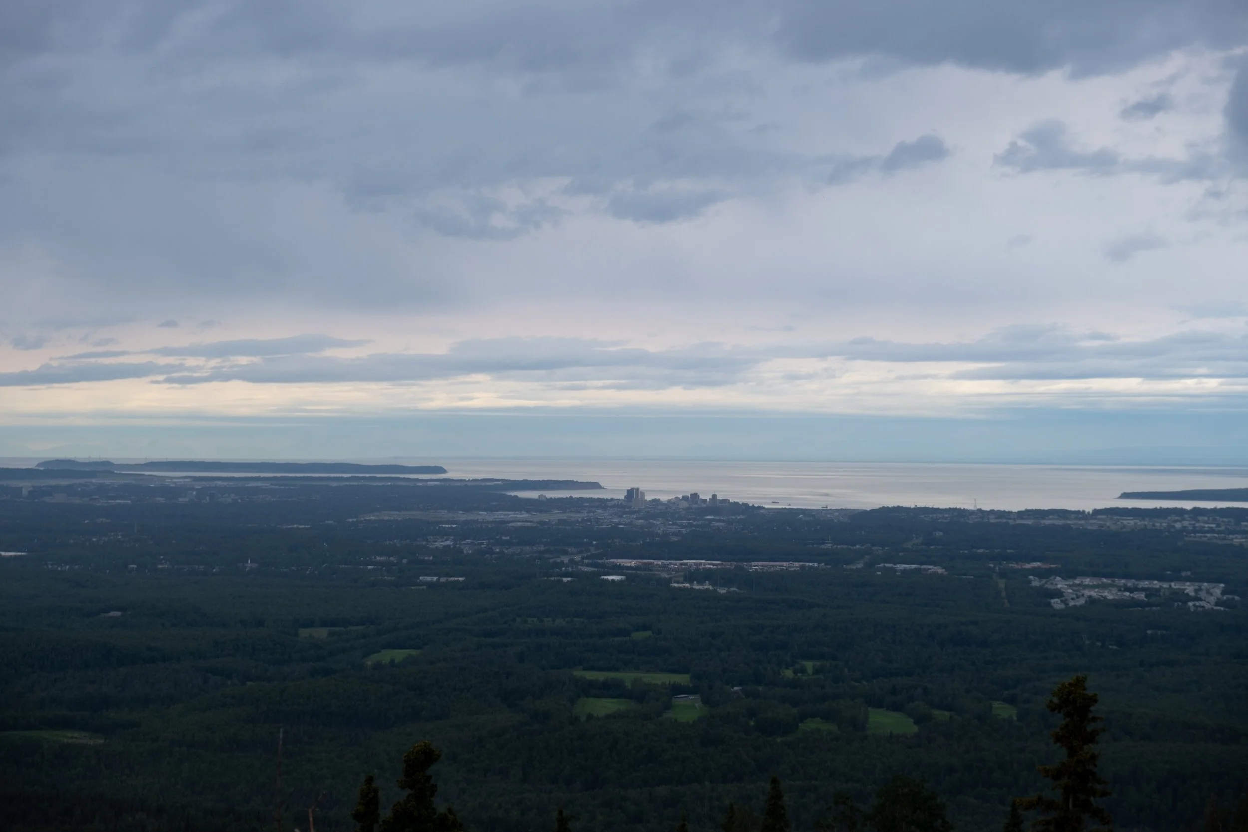
One thing I loved about the summer was the proliferation of bright flowers. Here you can see a few of the ones I encountered, along with your typical ferny underbrush. The explosion of poppies is my nextdoor neighbor’s wild garden, and the low pink groundcover was spotted at the top of the Exit Glacier, where the dark stones were so warm from soaking up the sun that I laid down on them for a while. There’s a picture of Anchorage from above, and one of my favorite type of wildlife – the bumblebee.


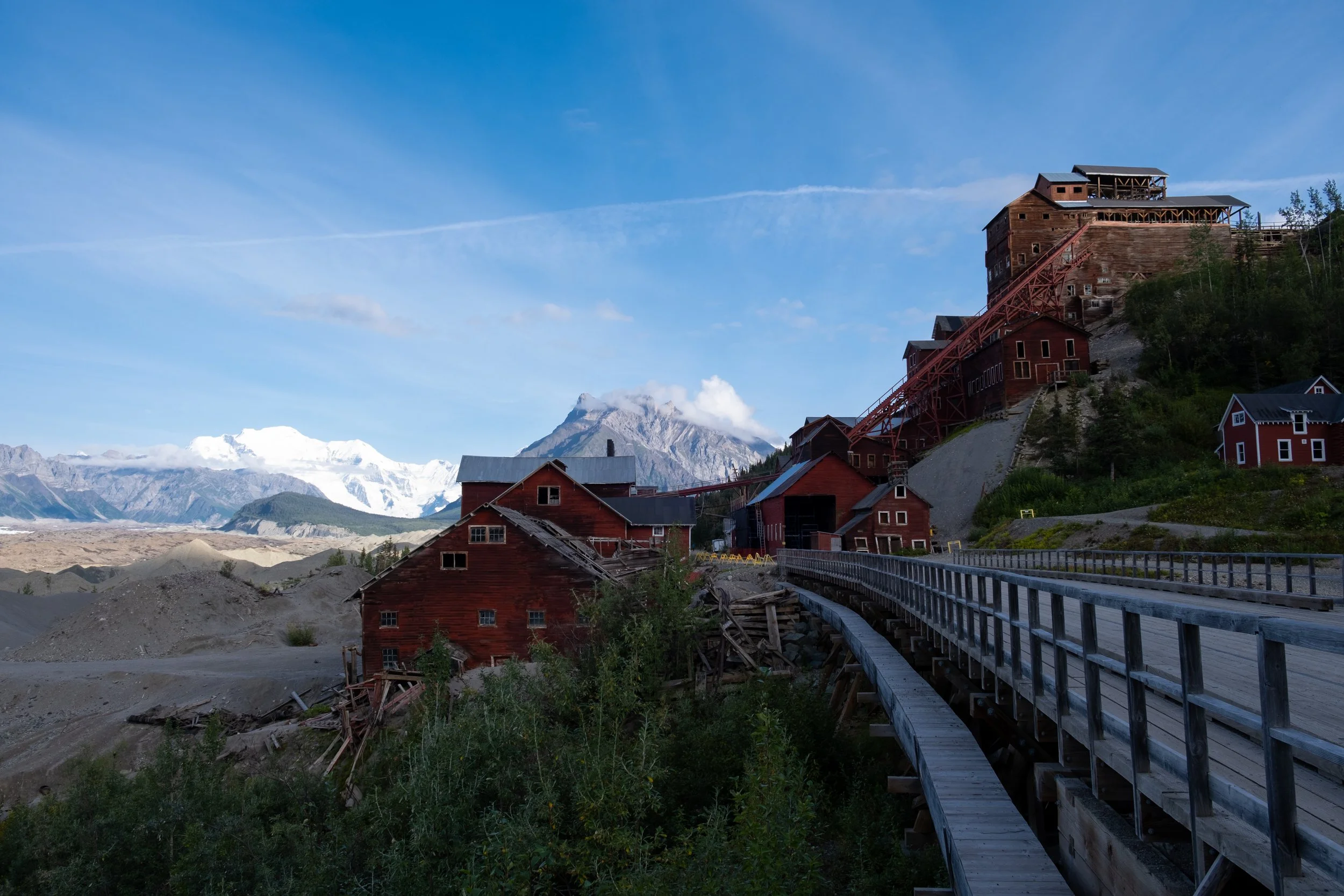
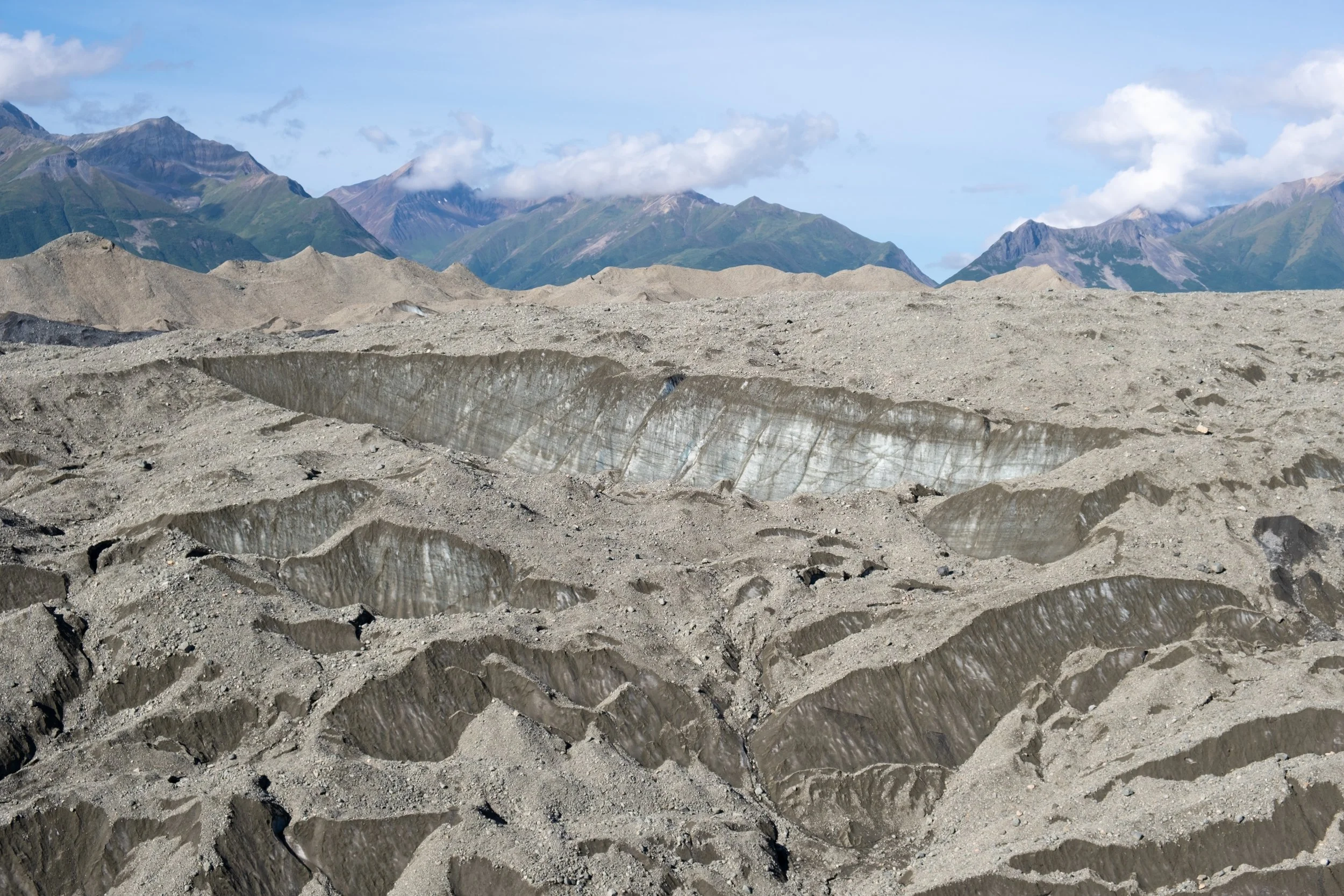
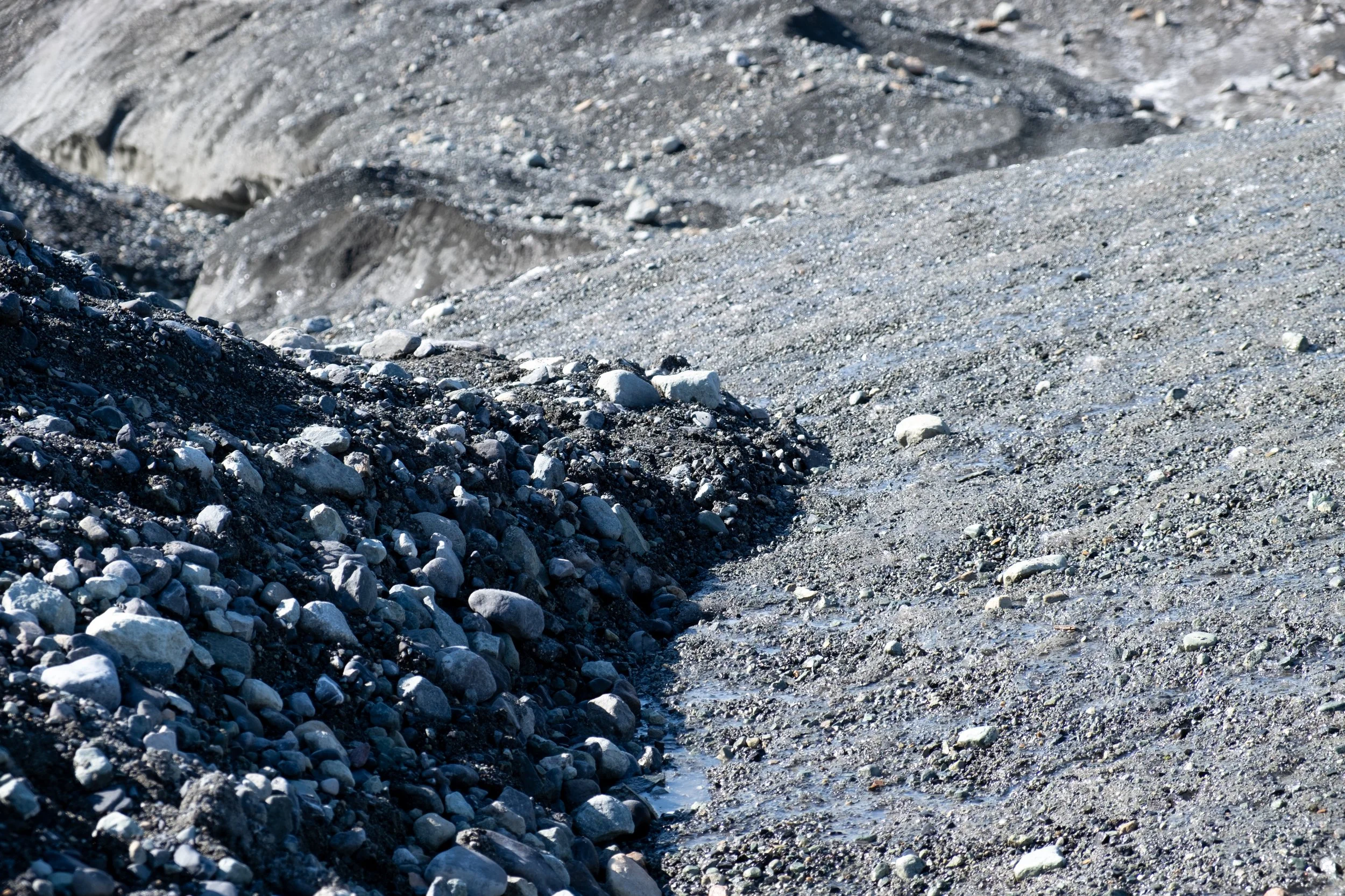
I made one final trip that summer, and finally completed by journey to McCarthy. Along the way I crossed the Copper River, traveled through the some of the most glorious country I have seen, and finally came to a tiny town at the end of the last road. A couple miles uphill was the creaking ruin of the Kennecott Mine, which for thirty years was a bustling town with families and children and trains to the coast – and then just as soon as it appeared, it was all gone. But the ruin is incredible, and it sits just above a vast glacier, which appears like so many hills of dirt on the march. Just north of the mine, past fields of glowing fuzz, I was able to step onto the icy toe of the Root Glacier. My typically poor planning (or improvisational style, if you prefer) had left me unshod to go any further – but there’s always next time.